Contour mapping
VEC provides the facility of drawing contour maps for a grayscale image.
Before drawing a contour map, check the density distribution (in grey level) by
clicking the mouse at different places of the image and see the change
of density values (in grey level) displayed in the bottom line of the VEC
window. Then select the lowest and highest grey level for contour mapping.
If the highest and the lowest density portions contain no important details,
it is recommended to keep them out of the mapping region. Contours can
be drawn as solid lines or dashed lines. By giving a greyscale value and
selecting 'above' (or 'below') next to 'solid lines' in the dialog box,
contours at and above (or below) the given level will be drawn as solid
lines while others will be in dashed lines.
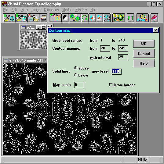
Example
Click the
button  when the upper small sub window is the current window. Fill the data boxes
within the dialog box and then click 'OK'. The contour map will appear as that
shown in the lower window. This contour map can be saved as a *.CON file.
You can insert the contour map as an object into an MS Word document from
the *.CON file provided you have associated the file with the program CONTOUR.EXE,
which is stored in the directory '..\VEC\exe\'.
when the upper small sub window is the current window. Fill the data boxes
within the dialog box and then click 'OK'. The contour map will appear as that
shown in the lower window. This contour map can be saved as a *.CON file.
You can insert the contour map as an object into an MS Word document from
the *.CON file provided you have associated the file with the program CONTOUR.EXE,
which is stored in the directory '..\VEC\exe\'.